Tide Chart – May 2022
Tides are the rise and fall of sea levels caused by the combined effects of the gravitational forces exerted by the Moon and the Sun, and the rotation of the Earth. Tide tables can be used for any given locale to find the predicted times and amplitude. Below you will see the tide chart for Shallotte Inlet, NC.
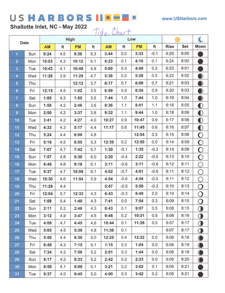
Tidal Data Source: Shallotte Inlet, NC (#8659665) – This program is distributed in the hope that it will be useful, but WITHOUT ANY WARRANTY; without even the implied warranty of MERCHANTABILITY or FITNESS FOR A PARTICULAR PURPOSE. Both the author and the website provider assume no liability for damages arising from use of these predictions. They are not certified to be correct, and they do not incorporate the effects of tropical storms, El Niño, seismic events, continental drift, or changes in global sea level.
Looking to Live Here?